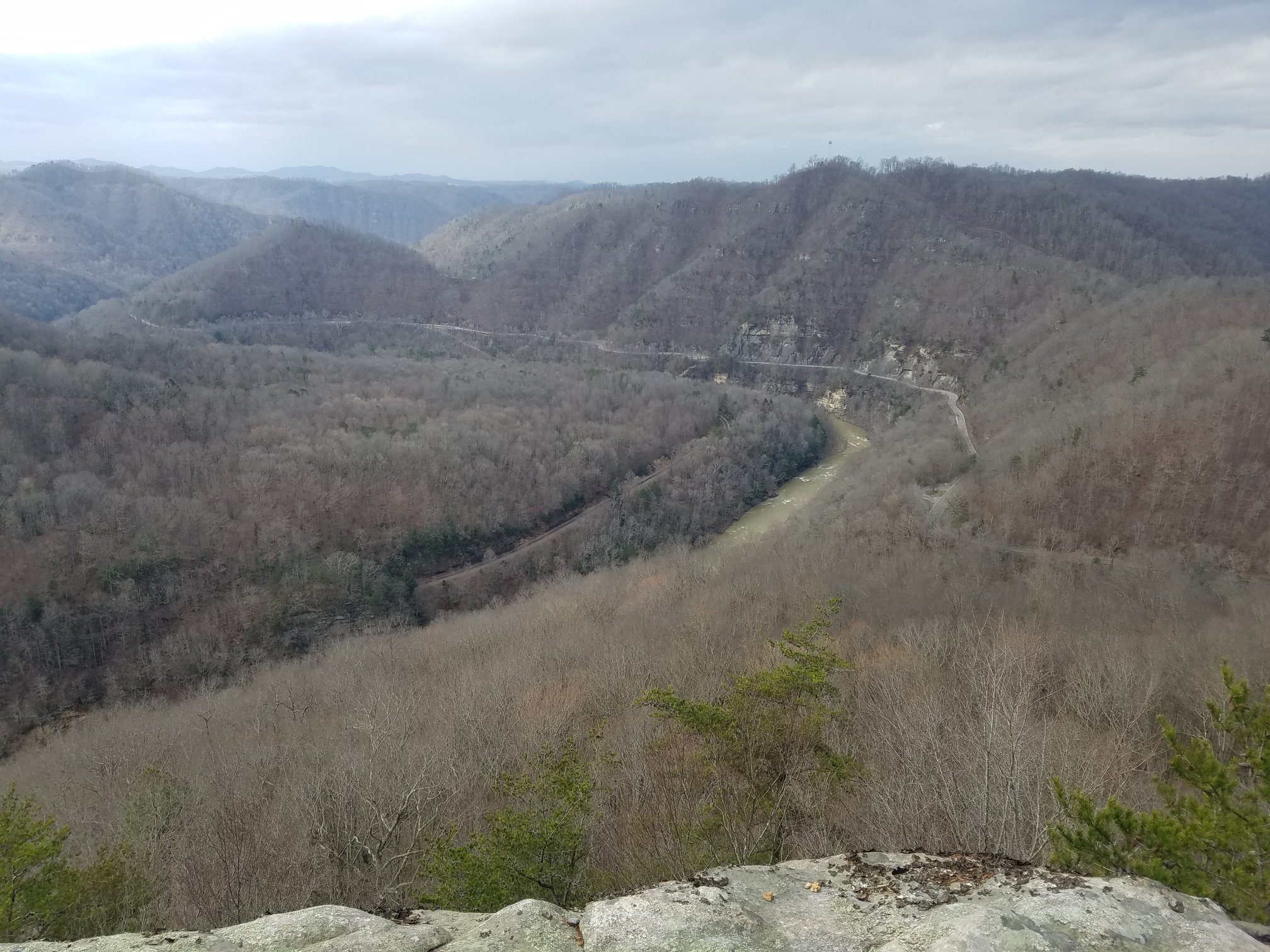
The Russell Fork is a dam-controlled river. John W. Flannagan Dam releases water into the Pound River. The Pound River flows from the dam to Haysi, where it joins the Russell Fork. The combined flow then travels downstream past Bartlick and into the Breaks gorge. This guide covers the official 2026 release schedule, river sections, gauges, viewing and safety.
The U.S. Army Corps of Engineers Huntington District published the following 2026 release schedule for the Russell Fork. The schedule was updated July 23, 2026. Release plans can change because of reservoir conditions, weather, inflow or operational requirements. Verify the official schedule and current project conditions before traveling or entering the river.
2026 Russell Fork scheduled release dates, days, times and flows
Dates
Days
Release window
Scheduled flow
October 2-4, 2026
Friday-Sunday
9:30 AM-3:30 PM Eastern
800 cfs scheduled release
October 10-11, 2026
Saturday-Sunday
9:30 AM-3:30 PM Eastern
800 cfs scheduled release
October 17-18, 2026
Saturday-Sunday
9:30 AM-3:30 PM Eastern
800 cfs scheduled release
October 23-25, 2026
Friday-Sunday
9:30 AM-3:30 PM Eastern
1,000 cfs scheduled release
USACE notes that target flow is 1,100 cfs, consisting of the scheduled 800 cfs release plus Russell Fork flow, and should not exceed 1,300 cfs at the Bartlick gauge. Scheduled discharge and actual downstream river flow are not necessarily the same.
The Russell Fork is described by American Whitewater in three sections with different classifications. Check current gauges, official schedules and local access information before paddling.
Upper Russell Fork: Bartlick Bridge to Garden Hole
Russell Fork, Virginia
The Upper Russell Fork section runs approximately three miles from Bartlick Bridge to Garden Hole. American Whitewater rates this section Class II-III+.
Russell Fork Gorge: Garden Hole to Breaks Park River Access
Russell Fork, Virginia to Kentucky
The approximately four-mile Gorge section runs from Garden Hole Road in Breaks Interstate Park, Virginia, to Breaks Park River Access in Kentucky. American Whitewater rates this section Class IV-V+.
The Gorge section is expert Class IV-V+ whitewater. The published schedule does not guarantee actual river conditions. Paddlers must check official schedules, current gauges and local access information. Inexperienced paddlers should use a qualified commercial outfitter. Spectators must not enter release-flow water.
Stay in Haysi Near the Release Source and Bartlick Bridge
Need a Clean, Comfortable, Private Suite in Haysi?
Flannagan Lodge is 3.6 miles from John W. Flannagan Dam and 7.4 miles from the Bartlick Bridge put-in, with off-street parking for trucks and trailers.
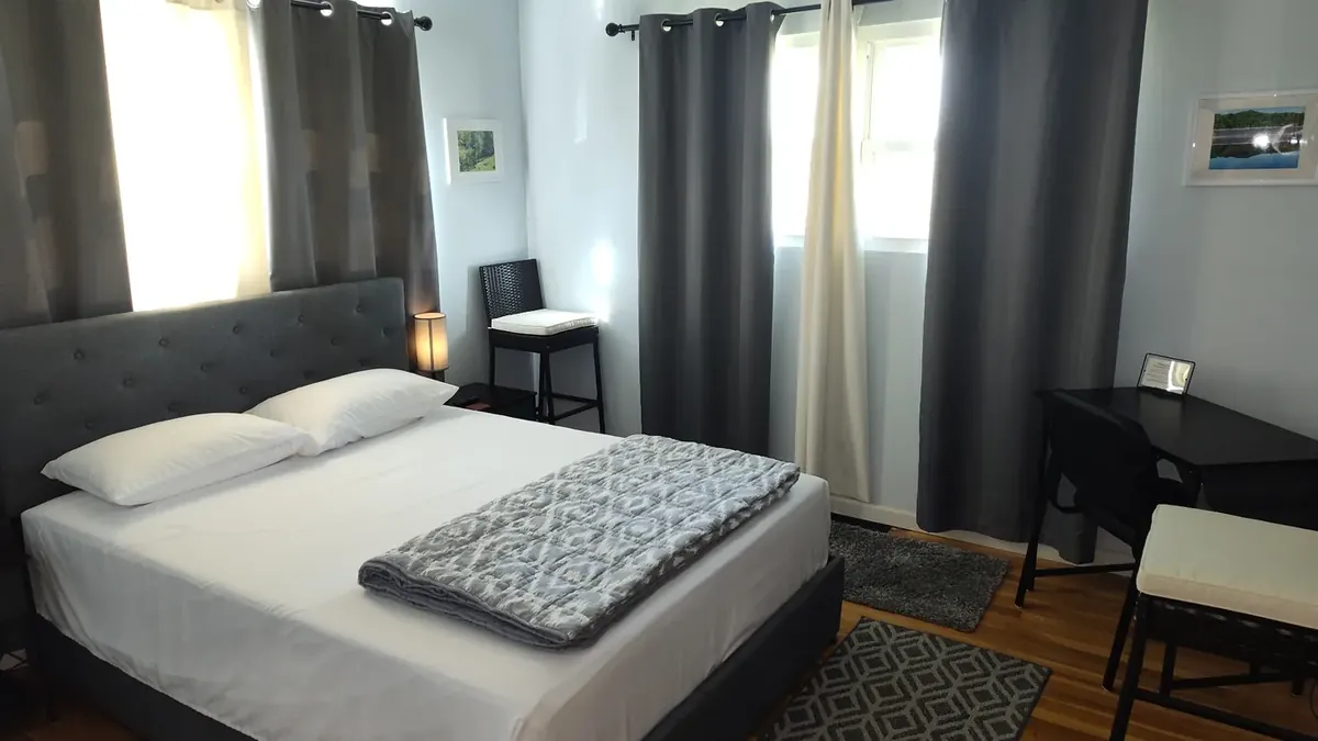
Flannagan Lodge was taken down to the bones and completely remodeled in 2022 and 2023. Enjoy two comfortable queen bedrooms, a private guest bathroom with a hot shower, a private entrance, a dedicated lounge/dining/game/work room, fiber Wi-Fi, Smart TVs, a private deck and off-street parking.
Reserved for one guest group at a time. No shared guest spaces.
"The place was spotless and the amenities were great."
Both buttons open the exact Flannagan Lodge listing. Vrbo is part of Expedia Group.
What Are the Russell Fork Whitewater Releases?
The Russell Fork of the Big Sandy carves through the deepest canyon east of the Mississippi at Breaks Interstate Park - but for most of the year the gorge runs too low to paddle. The river is dam-controlled. Water for the whitewater season comes from scheduled releases at John W. Flannagan Dam, a federal flood-control reservoir on the Pound and Cranes Nest rivers upstream, operated by the U.S. Army Corps of Engineers Huntington District.
Each October the Corps opens the dam's outlet works on a published schedule and sends a controlled discharge into the Pound River. Release periods vary by year: some run Friday through Sunday and some run Saturday and Sunday only. The Pound River flows from the dam to Haysi, where it joins the Russell Fork, and the combined flow then travels downstream past Bartlick and into the Breaks gorge.
Typical Annual Timeline - Flannagan Reservoir & Russell Fork
How Releases Are Created From Flannagan Dam
John W. Flannagan Dam is a rock-fill dam completed in the 1960s by the U.S. Army Corps of Engineers, named for Congressman John W. Flannagan Jr. of Southwest Virginia. The reservoir stores water for flood control on the Big Sandy basin, with recreation, cold-water fisheries, and downstream whitewater as secondary benefits.
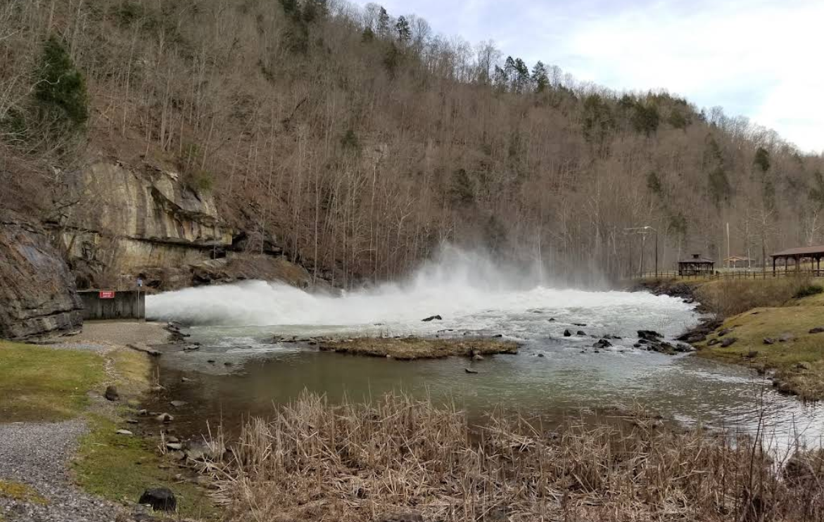
During a scheduled release, project operators open the dam's outlet works to a target discharge, typically measured in cubic feet per second (cfs). That flow enters the Pound River immediately below the dam, passes the Below the Dam Recreation Area, and continues downstream to Haysi, where the Pound River joins the Russell Fork. Scheduled discharge and actual downstream river flow are not necessarily the same.
The Corps holds Flannagan Reservoir at a higher summer recreation pool through the warm months, then draws it down each fall to a lower winter pool. The lower pool creates storage capacity for the wet-season flood pulses that arrive between late fall and spring.
The October whitewater releases happen during this drawdown. The water sent into the Pound River on release days is water leaving the reservoir on its way to winter pool, which is why the releases are scheduled together in October rather than spread through the year. When the reservoir has hit winter pool, the whitewater season is over until the following fall.
Class III, IV, and V Whitewater - A Beginner's Explanation
Rapids are rated on the American Whitewater International Scale of River Difficulty from Class I (easy moving water) to Class VI (extreme, near the limit of navigability). The short version:
Class III - Intermediate. Moderate waves, obvious routes, some scouting and maneuvering.
Class IV - Advanced. Powerful rapids with unavoidable waves and holes; precise moves required; consequences increase.
Class V - Expert. Long, violent rapids with serious hazards, mandatory scouting, and difficult rescues.
Class VI - Extreme. Near the limit of navigability; only exploratory descents by top experts.
The three sections carry different ratings. American Whitewater rates the Upper Russell Fork from Bartlick Bridge to Garden Hole Class II-III+, and the Gorge from Garden Hole to Breaks Park River Access in Kentucky Class IV-V+. The Gorge is expert whitewater and is not a section for beginners in private boats. Newer paddlers who want to experience the gorge should book a commercial guided raft trip with an outfitter.
Russell Fork Gorge, Garden Hole to Breaks Park River Access (upstream → downstream)
Watching From Shore: Spectator & Photography Guide
Release weekends draw paddlers from across the country - and a matching crowd of photographers, families, and river fans on the rim. You do not have to paddle Class V to have a memorable release day.
Towers Tunnel Overlook - the classic gorge-rim vantage. Bring binoculars and a 200-400mm lens.
Stateline Overlook - wider canyon frame, quieter crowds. Good for a longer sit.
Garden Hole - close river-level views inside Breaks Park, where the Upper section ends and the Gorge begins.
Potters Flats (VA-80) - roadside river-level pull-offs between Haysi and the Breaks.
Below the Dam Recreation Area - beside the Pound River immediately below the dam, watch water leave the outlet works and start its trip downstream. See our Below the Dam guide.
Safety Information
Skill honesty. Class IV-V means Class IV-V. If you are not a confident Class V boater with recent river time, book a commercial raft trip - do not put on in a private boat.
Cold water year-round. The Pound River immediately below the dam is cold even on warm October days. A drysuit or full wetsuit is standard.
Rescues are hard. The gorge is remote, cell service is unreliable, and evacuation is difficult. Paddle with a competent group.
Never paddle alone. Even locals do not solo the gorge on release flow.
Spectators, stay back. Below the Dam and Potters Flats look inviting - but release-flow water is fast, cold, and unforgiving. Do not wade.
Know which section you are on. The Upper, Gorge and Lower sections of the Russell Fork carry different classifications. See the American Whitewater river sections listed above for current descriptions and incident history.
Get a guide if you are not an expert.Inexperienced paddlers should run the river with a qualified commercial outfitter rather than a private boat.
Typical October Weather in the Gorge
October in Southwest Virginia averages daytime highs in the 60s F, nights in the 40s. Fall foliage in the Breaks canyon peaks mid-to-late October - one of the reasons release weekends are also the busiest photography weekends of the year. Rain is common and can push flows well above the scheduled release; the gorge holds cold air and shadow late into the morning.
Check the National Weather Service Haysi forecast the day before you travel, and pack layered rain gear plus a full warm change of clothes for the take-out.
Understanding River Flow (cfs) and Gauges
River flow is measured in cubic feet per second (cfs) - the volume of water passing a point each second. Gauges also report stage, the height of the water surface at the gauge. On a dam-controlled river, the scheduled release sets a target discharge at the dam, but what actually reaches the run depends on tributary inflow, antecedent rain, and how long the release has been running.
USGS Pound River Below Flannagan Dam (station 03209000) reports conditions below the dam. USGS Russell Fork at Haysi (station 03208500) reports conditions at Haysi, where the Pound River joins the Russell Fork. Neither gauge guarantees conditions in the Gorge. Read both on the morning of your trip rather than relying on a release plan published earlier.
John W. Flannagan Dam - Pound River Release Source
The U.S. Army Corps of Engineers releases water from Flannagan Dam into the Pound River on scheduled fall weekends, and that water creates the Russell Fork whitewater season each October.
John W. Flannagan Dam releases water into the Pound River. The Pound River flows from the dam to Haysi, where it joins the Russell Fork. The combined flow then travels downstream past Bartlick and into the Breaks gorge. Release dates, daily times and scheduled flows are published by the Corps and can change because of reservoir conditions, weather, inflow or operational requirements. Confirm the official schedule and current project conditions before traveling.
Bartlick Bridge is the put-in for the Upper Russell Fork, the approximately three-mile section that runs down to Garden Hole. American Whitewater rates the Upper section Class II-III+.
Bartlick Bridge sits downstream of Haysi, where the Pound River has already joined the Russell Fork. From Bartlick the Upper Russell Fork runs roughly three miles to Garden Hole and is rated Class II-III+ by American Whitewater. This is not the Class IV-V+ Gorge, which begins downstream at Garden Hole. Check the published release schedule and the current gauges before you put on, and remember that a scheduled discharge does not guarantee the flow you will find on the water.
Garden Hole is the takeout for the Upper Russell Fork and the put-in for the Class IV-V+ Russell Fork Gorge.
Garden Hole is reached by Garden Hole Road inside Breaks Interstate Park, Virginia. Paddlers finishing the Upper Russell Fork take out here, and paddlers running the approximately four-mile Class IV-V+ Gorge section to Breaks Park River Access in Kentucky put on here. It is also a standard scout and safety-crew location during release weekends, and a productive fishing spot when the river is low.
River / section
Russell Fork (Upper takeout, Gorge put-in)
Class / use
Gorge below this point is Class IV-V+
Address
Garden Hole Road, Breaks Interstate Park, Breaks, VA 24607
Take-Out 4 of 9 - ~24 mi from Flannagan Lodge via shuttle
Breaks Park River Access, Kentucky - Gorge Takeout
Breaks Park River Access in Kentucky is the takeout for the Russell Fork Gorge and the put-in for the Lower Russell Fork.
The approximately four-mile Gorge section ends at Breaks Park River Access in Kentucky. Paddlers continuing downstream put on here for the Lower Russell Fork, which runs toward and below Elkhorn City. Shuttle drives between the Virginia access points and the Kentucky takeout go over the mountain, so plan vehicle logistics before you launch.
Take-Out 5 of 9 - ~25 mi from Flannagan Lodge via shuttle
Elkhorn City and Ratliff Hole - Lower Russell Fork Access
Lower-river and extended-run access near Elkhorn City, Kentucky. This is not the immediate takeout for the Gorge.
Ratliff Hole and the accesses around Elkhorn City serve the Lower Russell Fork, which continues from Breaks Park River Access toward and below Elkhorn City. Paddlers who take out here have run an extended trip past the immediate Gorge takeout. Coordinate shuttle with a second vehicle or with a commercial outfitter.
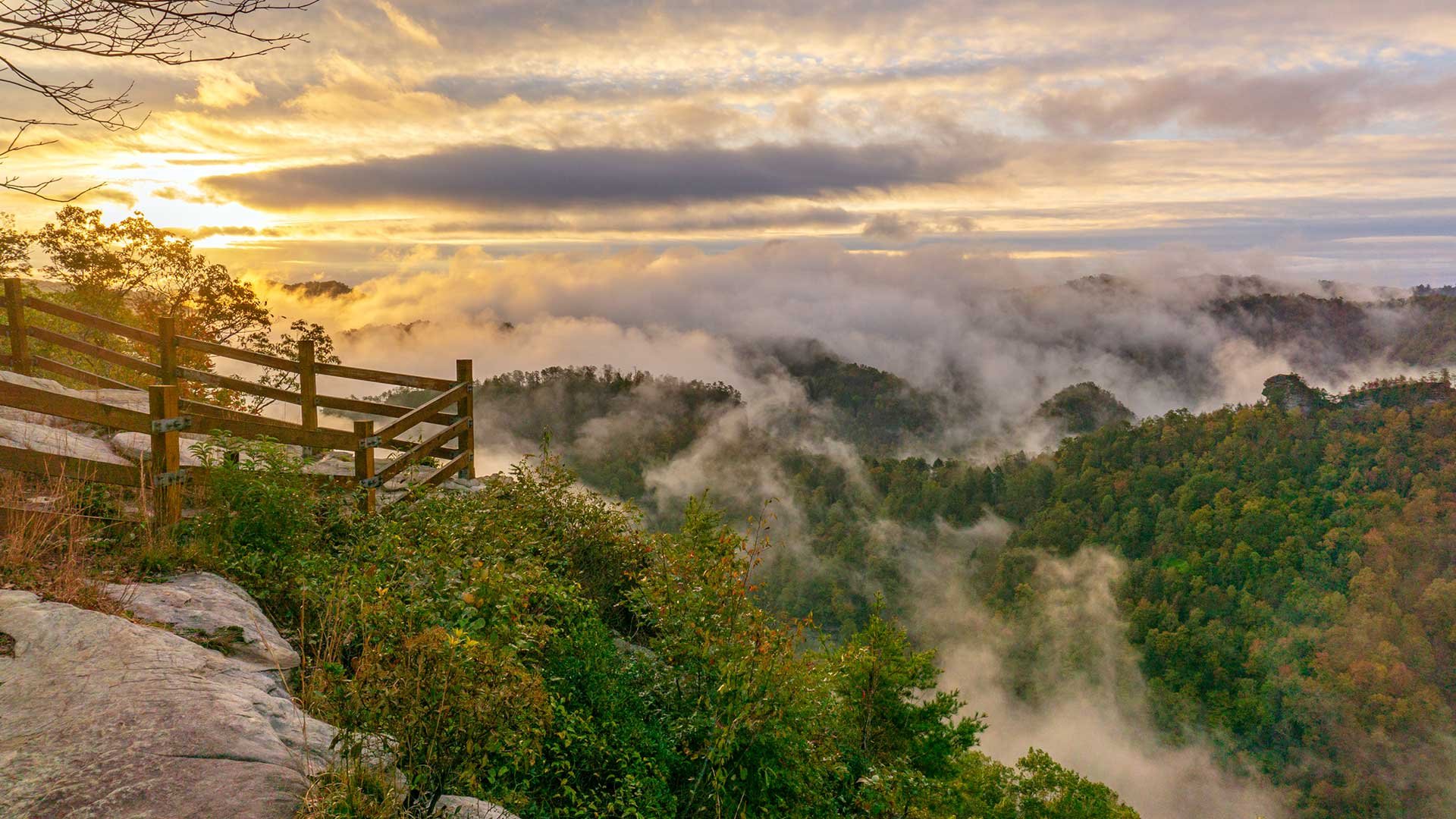
Iconic overlook above the Russell Fork - during October releases you can watch paddlers thread the rapids around the Towers formation from a railed deck high above the gorge.
The Towers Tunnel Overlook deck inside Breaks Interstate Park is the best free vantage to watch the Russell Fork at flood-release flows. Paddlers and rafts appear as bright specks running the rapids below the Towers formation. Bring binoculars and a long lens. Easy walk from the parking area, suitable for kids and grandparents.
River / section
Russell Fork (overhead view)
Class / use
Viewing only - no river access
Address
Towers Tunnel Overlook, Breaks Interstate Park, Breaks, VA 24607
Park-rim overlook with a wide view down the gorge - a quieter spot to watch the river run during release weekends.
Stateline Overlook sits on the south end of the Overlook Trail and frames the canyon where Virginia meets Kentucky. During release weekends it is a calmer, less crowded vantage than Towers Tunnel - good for a longer sit with coffee while paddlers work the rapids below.
River / section
Russell Fork (overhead view)
Class / use
Viewing only
Address
Stateline Overlook, Breaks Interstate Park, Breaks, VA 24607
Roadside river-level view along the Russell Fork on the drive between Haysi and the Breaks - a good safety-crew and spectator pull-off during releases.
Potters Flats is a stretch of road that parallels the Russell Fork between Haysi and the Breaks. There are several informal pull-offs where you can stand at river level and watch the water move - especially useful on release weekends when boats are running through. Use real pull-offs, not the travel lane, and watch for safety-crew vehicles.
River / section
Russell Fork (river level)
Class / use
Viewing - roadside
Address
VA-80 between Haysi and the Breaks, Haysi, VA 24256
Outfitter 9 of 9 - Pickup typically at the Breaks - ~10 mi from Flannagan Lodge
Russell Fork Whitewater Outfitters - Guided Rafting Trips
Commercial outfitters run guided raft trips on the Russell Fork during October release weekends - the right way to experience the gorge if you are not a Class IV-V+ paddler.
If you want to run the Russell Fork without being an expert kayaker, book a guided commercial raft trip with one of the outfitters working the river during the October release season. Outfitters typically include gear, professional river guides, safety kayakers, shuttle from a base camp to the put-in, and lunch. Trips fill fast - book months ahead. Operators change year to year; the Breaks Interstate Park visitor center can point you at currently active outfitters.
River / section
Russell Fork - guided
Class / use
Class IV-V (guided)
Address
Trip meeting locations vary - confirm with operator
Distance from lodge
Pickup typically at the Breaks - ~10 mi from Flannagan Lodge
The Russell Fork whitewater season runs in October on scheduled dam-release weekends from John W. Flannagan Dam. Release periods vary by year: some run Friday through Sunday and some run Saturday and Sunday only. Published dates, times and scheduled flows can change. Outside those release days and rare high-water events, the Gorge is usually too low to paddle.
Where can I find the official Russell Fork release schedule?
The U.S. Army Corps of Engineers Huntington District publishes the whitewater release schedule through its Water Management site. Dates, daily start and stop times and scheduled flows are set there and can change. Always confirm the official schedule and current project conditions before you travel; local guides and social posts sometimes lag behind the Corps' updates.
How are the whitewater releases created from Flannagan Dam?
Flannagan Dam is a flood-control reservoir operated by the U.S. Army Corps of Engineers. During scheduled release days, project operators open the dam's outlet works to send a controlled flow of water into the Pound River. The Pound River flows from the dam to Haysi, where it joins the Russell Fork, and the combined flow travels downstream past Bartlick and into the Breaks gorge. Scheduled discharge and actual downstream river flow are not necessarily the same.
What is the Winter Pool drawdown and how does it relate to releases?
Each fall the Corps draws John W. Flannagan Reservoir down from summer recreation pool to a lower winter pool to create flood-storage capacity for the wet season. The scheduled October whitewater releases happen during this drawdown. The water sent into the Pound River is water being moved out of the reservoir on its way to winter pool.
What flow rate makes the Russell Fork runnable?
USACE notes that target flow is 1,100 cfs, consisting of the scheduled 800 cfs release plus Russell Fork flow, and should not exceed 1,300 cfs at the Bartlick gauge. Scheduled discharge and actual downstream river flow are not necessarily the same. Always check current gauges before you put on and follow guidance from experienced local paddlers.
What does Class III, IV, and V whitewater mean?
American Whitewater's international scale rates rapids I to VI. Class III is intermediate: moderate waves, obvious routes, some maneuvering. Class IV is advanced: powerful rapids, unavoidable waves and holes, precise moves required. Class V is expert: long, violent rapids with serious consequences and mandatory scouting. Class VI is considered near the limit of navigability. The Russell Fork Gorge from Garden Hole to Breaks Park River Access is rated Class IV-V+.
What are the named rapids on the Russell Fork?
The classic Russell Fork gorge run through the Breaks includes Tower Falls, Triple Drop, El Horrendo, Climax, S-Turn, and Fist among its named Class IV-V rapids. Each has multiple lines depending on flow. Paddlers who do not know the river should scout, follow experienced boaters, or run guided; the consequences of a bad line are serious.
What class are the Russell Fork rapids on release weekends?
On October release flows, the Russell Fork Gorge below Garden Hole is Class IV-V+ whitewater, expert paddling with named rapids including Tower Falls, Triple Drop, El Horrendo, Climax, and S-Turn. It is not a beginner river. Newer paddlers should run it with a commercial outfitter, not on private boats.
Where do paddlers put in and take out on the Russell Fork?
Bartlick Bridge is the put-in for the Upper Russell Fork, which runs about three miles to Garden Hole and is rated Class II-III+. Garden Hole is the Upper takeout and the put-in for the Class IV-V+ Gorge, which ends at Breaks Park River Access in Kentucky. The Lower Russell Fork continues toward and below Elkhorn City.
Where can I watch Russell Fork whitewater from shore?
The best free shore viewing during October releases is from Breaks Interstate Park - Towers Tunnel Overlook and Stateline Overlook look down into the gorge. Garden Hole, inside the park, gives close river-level viewing during releases. Roadside pull-offs along VA-80 at Potters Flats let spectators watch from river level between Haysi and the park.
Where can I photograph the Russell Fork whitewater?
Photographers work three main zones: Towers Tunnel Overlook for classic gorge-rim shots with paddlers as scale, Garden Hole for close river-level action of raft crews finishing the gorge, and Potters Flats for wide roadside frames of the river between Haysi and the Breaks. A long lens (200-400mm) is essential from the overlooks; morning light favors the Virginia rim.
Can I book a guided rafting trip on the Russell Fork?
Yes. Commercial outfitters run guided raft trips on the Russell Fork during the October release weekends. Trips typically include gear, professional river guides, safety kayakers, shuttle, and lunch. Trips fill months in advance. Operators change year to year, so confirm current availability with the Breaks Interstate Park visitor center or the outfitter directly.
Can beginners paddle the Russell Fork?
No, not in a private boat. The Russell Fork Gorge on release flow is Class IV-V+, with consequential rapids and long swims. Beginners and intermediate paddlers should book a commercial guided raft trip with an outfitter running the river, where professional guides, safety kayakers, and rescue gear are on the water throughout the run.
How dangerous is the Russell Fork?
The Russell Fork is one of the most serious expert runs in the eastern United States. Rapids are technical with pinning and undercutting hazards, water is cold, and rescues in the gorge are difficult. Fatalities have occurred. Every paddler should have Class V experience, a helmet, drysuit or wetsuit, throw bag, and a partner they trust.
Do I need a permit to paddle the Russell Fork?
No paddling permit is required to run the Russell Fork through the Breaks. However, Breaks Interstate Park charges a per-vehicle entrance fee for access to Garden Hole Road and the overlooks, and commercial outfitters operate under their own permits. Confirm current park fees at breakspark.com before your trip.
What are the USGS gauges for the Russell Fork?
USGS 03208500, Russell Fork at Haysi, reports conditions at Haysi where the Pound River joins the Russell Fork. USGS 03209000, Pound River Below Flannagan Dam, reports conditions below the dam. Neither gauge guarantees conditions in the Gorge. Check both on the morning of a run, not just the release schedule.
What is a river gauge and why does it matter?
A river gauge is a USGS instrument that measures water flow (in cubic feet per second, or cfs) and river stage (height) in real time. Paddlers rely on gauges to decide whether a river is too low, in-range, or too high to run safely. On dam-controlled rivers like the Russell Fork, the gauge shows what actually reached the run, not just the release plan.
What is the weather like on Russell Fork release weekends?
October in the Southwest Virginia mountains averages daytime highs in the 60s F, nights in the 40s, with cold water year-round in the tailwater. Rain is common and can push flows above scheduled release levels. Bring layered rain gear, a warm change of clothes for the take-out, and check the National Weather Service forecast for Haysi the day before you paddle.
How long is the Russell Fork gorge run?
The Upper Russell Fork from Bartlick Bridge to Garden Hole is approximately three miles. The Class IV-V+ Gorge from Garden Hole to Breaks Park River Access in Kentucky is approximately four miles and commonly takes several hours with scouting. The Lower Russell Fork continues toward and below Elkhorn City. Add shuttle drive time over the mountain.
Do the release dates ever change?
Yes. The U.S. Army Corps of Engineers may adjust release dates, flow rates, or daily start and stop times based on reservoir conditions, weather, downstream flooding, dam operations, and safety. The published Corps schedule controls; local rumors and outdated posts do not. Always confirm the current schedule on the official Corps Water Management schedule page and check the live Flannagan project dashboard before you travel.
Can I fish the Russell Fork during a release weekend?
During scheduled releases the river runs high, cold, and fast, which is not fishable water and unsafe to wade. Garden Hole and Russell Fork wade access become productive again after releases end and the river drops. See our Fishing Near Haysi guide for lake, tailwater, and river-level details plus the current Virginia consumption advisory.
How far is the Russell Fork from Flannagan Lodge?
Flannagan Lodge is 3.6 miles from John W. Flannagan Dam (the release source), 7.4 miles from the Bartlick Bridge put-in, and 10 miles (20 to 25 minutes) from Breaks Interstate Park, including Garden Hole river access - one of the closest comfortable basecamps for a Russell Fork release weekend whether you are paddling, supporting a crew, or watching from the rim.
Where should I stay for a Russell Fork release weekend?
Flannagan Lodge is a private 2-bedroom guest suite in Haysi, VA, with off-street parking for trucks and trailers, a private entrance for early launches and late take-outs, fast Wi-Fi for checking flow gauges and shuttle plans, and a hospitality station for pre-dawn coffee. Reservations are made through Airbnb or Vrbo; October release weekends book up months ahead.
Is there cell service in the Russell Fork gorge?
No, effectively not. Cell coverage in the Breaks canyon is unreliable to nonexistent. Plan your shuttle, put-in time, and emergency contacts before you leave pavement, and never rely on a phone call from the river. The Breaks Interstate Park visitor center and Flannagan Lodge both have working phones and Wi-Fi if you need to reach anyone.
What gear do I need for a Russell Fork release day?
For paddlers: whitewater kayak or raft, helmet, PFD, drysuit or thick wetsuit, throw bag, breakdown paddle, first-aid kit, and a partner. For spectators: warm layers, rain shell, sturdy shoes for overlook trails, binoculars, and a long telephoto lens (200-400mm) if you plan to photograph paddlers from the rim.
Who was John W. Flannagan Jr., the dam's namesake?
John W. Flannagan Jr. was a U.S. Congressman from Southwest Virginia who represented the region in the mid-20th century and championed federal water and public-works projects in the Appalachian coalfields. The Corps of Engineers reservoir on the Pound and Cranes Nest rivers was named in his honor when it was completed in the 1960s.
Who operates John W. Flannagan Dam?
John W. Flannagan Dam and Reservoir is a federal flood-control project owned and operated by the U.S. Army Corps of Engineers, Huntington District. The Corps manages the reservoir, sets the release schedule, operates the outlet works, and runs the day-use recreation areas around the lake and below the dam.
Can I access Below the Dam Recreation Area during a release?
Below the Dam Recreation Area (picnic shelters, playground, pickleball, restrooms) sits beside the Pound River immediately below the dam outlet and stays open during scheduled releases, but the river channel next to it runs high and fast. Stay well back from the water, do not wade, and expect louder-than-usual conditions from the outlet works during a release.
What if I do not want to paddle - is release weekend still worth visiting?
Yes. Release weekends draw a distinct festival crowd to the Breaks and Haysi - paddlers, photographers, safety crews, and river families. Watching the gorge from Towers Tunnel or Stateline overlooks is a memorable free experience, and fall foliage in Southwest Virginia peaks in mid-to-late October. Combine with a hike, a scenic drive, or a Below the Dam picnic.
I have another question not listed, how do I contact the host?
You can easily contact the host of Flannagan Lodge by sending a text to 276-865-1025, calling 276-865-1025 or sending a message from https://flannaganlodge.com/contact
Stay at Flannagan Lodge for Release Weekend
Flannagan Lodge is a private 2BR guest suite in Haysi, VA -3.6 miles from the dam, 7.4 miles from Bartlick Bridge, and 10 miles from Breaks Interstate Park. Off-street parking for trucks and trailers, a private entrance for early launches and late take-outs, fast Wi-Fi for gauge checks, and a hospitality station for the pre-dawn coffee that release weekends demand. Still comparing rooms for release weekend? Read our guide to hotels near Breaks Interstate Park.