Dam History Hub
The History of John W. Flannagan Dam
A century of Appalachian flooding, a landmark 1938 Flood Control Act, and a 250-foot dam of rock-fill with a central clay core completed in 1964 - here is how the John W. Flannagan Dam and Reservoir came to be, and how the U.S. Army Corps of Engineers operates it today for flood control, fisheries, whitewater, and recreation near Haysi, Virginia.
Why the Project Was Approved
The Levisa Fork, Russell Fork, and Big Sandy River drainages funnel enormous volumes of rainwater off the Cumberland Plateau. For generations, coalfield towns from Grundy to Pikeville lived with recurring, sometimes catastrophic floods. The 1937 Ohio River flood - one of the worst natural disasters in U.S. history - transformed federal policy and produced the Flood Control Act of 1938, which authorized dozens of Appalachian headwater dams. The Flannagan project on the Pound River was one of them, championed in Congress by the 9th District's Rep. John W. Flannagan Jr.
Regional Flooding Before Construction
Before the dam, Pound River and Russell Fork storms routinely inundated bottomland farms, rail lines, and downtown streets across Dickenson, Buchanan, and Pike counties. Loss of life and property was routine. Local newspapers from the 1920s through the 1950s document repeated evacuations, washed-out bridges, and destroyed coal tipples. The federal case for a flood control dam of rock-fill with a central clay core upstream of the confluence with the Russell Fork was overwhelming.
Construction Timeline
- 1937Great Ohio River Flood devastates downstream communities, building political will for Appalachian headwater flood control.
- 1938Flood Control Act authorizes the Flannagan project on the Pound River.
- 1940s-50sLand acquisition, surveys, and engineering design proceed under the U.S. Army Corps of Engineers, Huntington District.
- 1960Construction of the embankment begins in the steep Pound River gorge.
- 1964Dam completed and dedicated; reservoir begins filling and is named for the late Rep. John W. Flannagan Jr.
- 1960s-70sRecreation facilities develop - boat ramps, campgrounds, picnic areas, and the overlook.
- 1980s-presentScheduled October whitewater releases establish the Russell Fork as one of the premier Class IV-V rivers in the eastern U.S.
- TodayUSACE Huntington District continues to operate the dam for flood control, water quality, fish and wildlife, and recreation.
Historic timeline placeholder - to be enriched with archival USACE photographs and construction records.
Reservoir Creation
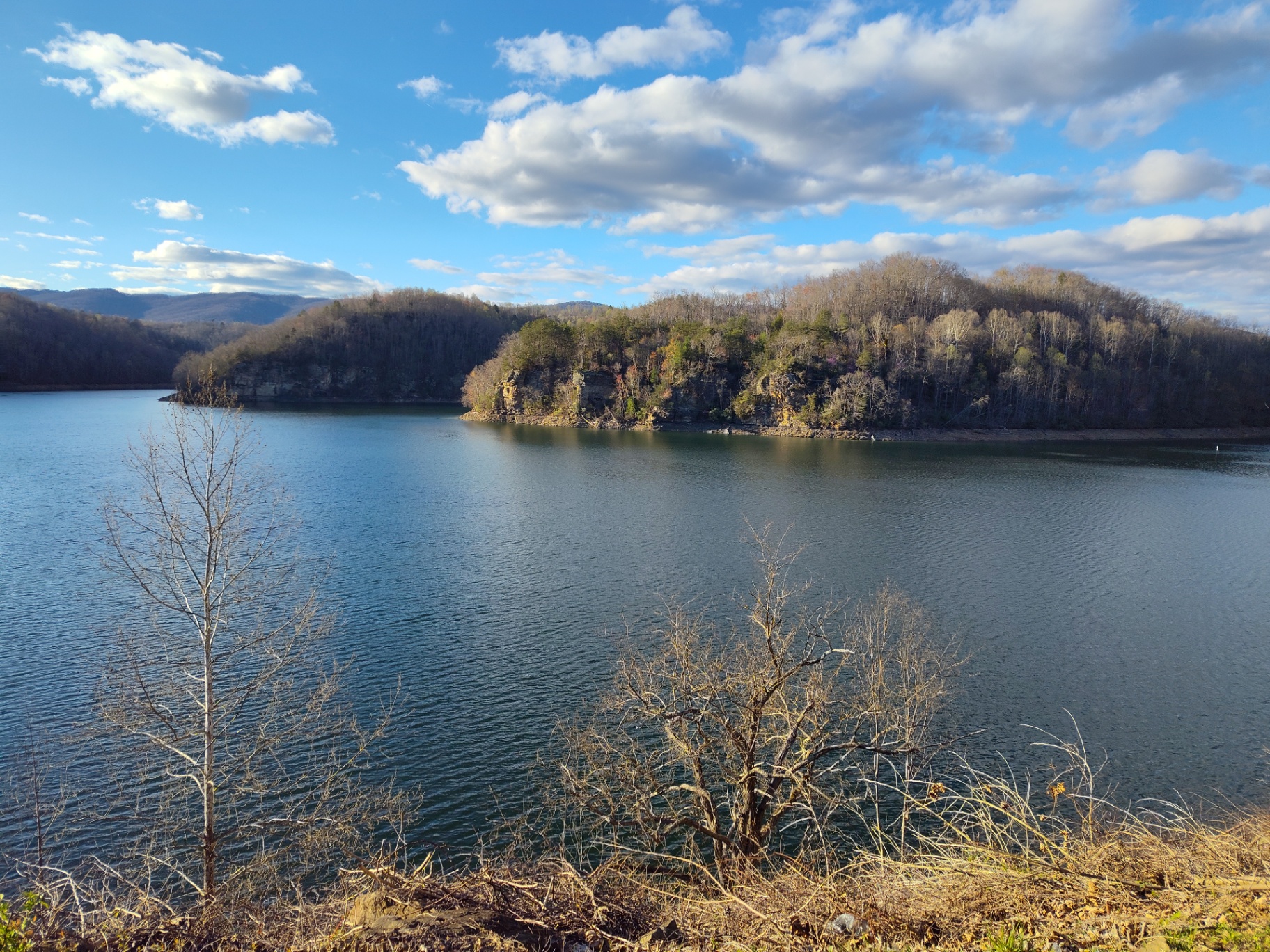
When the gates closed in 1964, the Pound River and its tributaries began to back up behind the 250-foot embankment. Over months, water climbed steep hollows and inundated old logging roads and homesites, ultimately forming the 1,145-acre John W. Flannagan Reservoir with roughly 40 miles of winding shoreline. The reservoir's finger-lake shape - a legacy of the Cumberland Plateau's tight ridges - is what makes it feel far larger than its surface acreage on the water.
Flood Control Mission
Flannagan Dam's primary job is unglamorous but life-saving: absorb storm inflows and meter them out to safe downstream rates. That is why the lake rises and falls with the calendar - see the Winter Pool Guide for how USACE reserves storage capacity for winter and spring. Since 1964, the project has captured every major storm without overtopping.
Recreation Development
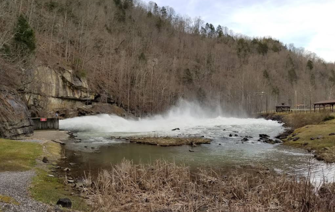
Through the late 1960s and 1970s, USACE developed boat ramps, campgrounds, picnic shelters, and the dam overlook. The Below the Dam Recreation Area became a favorite for families, anglers, and pickleball players. Beginning in the 1980s, scheduled October releases turned the Russell Fork downstream into one of the most respected Class IV-V whitewater rivers in the eastern United States - see the Russell Fork Whitewater Release Schedule.
Modern Visitor Experience
Today the reservoir hosts anglers chasing walleye and smallmouth, paddlers exploring quiet coves, campers at Pound River and Cranesnest, and visitors just stopping at the overlook. Fall whitewater weekends bring paddlers from across the country to Breaks Canyon. Flannagan Lodge sits 3.6 milesfrom the dam and is a convenient basecamp for exploring the reservoir, fishing the tailwater, or watching a release. See our Fishing Guide and Adventure Guides.
Explore the Flannagan Dam Content Hub
Deep-dives on the people, policies, and places that make the John W. Flannagan project one of the most consequential dams in Southwest Virginia.
Russell Fork Whitewater Release Schedule
How October releases from Flannagan Dam create Class III-V whitewater through Breaks Canyon.
Winter Pool Guide
Why USACE lowers the reservoir each fall, elevations, ramp closures, and what to expect.
John W. Flannagan Jr.
The Virginia congressman who championed the Flood Control Act and gave the dam its name.
US Army Corps of Engineers at Flannagan
How the Huntington District manages the dam, reservoir, and public recreation lands.
Fishing Guide
Species, access points, tailwater tactics, and the VDH consumption advisory.
Below the Dam Recreation Area
Picnic shelters, playground, pickleball, and tailwater access at the base of the dam.
Breaks Interstate Park & Nearby Attractions
The Grand Canyon of the South and other regional destinations within easy reach.
Flannagan Lodge
Private 2BR/1BA guest suite in Haysi - a convenient basecamp for exploring the dam and reservoir.
Coming Soon: Visual Content
- • Historic construction photographs (1958-1964)
- • Interactive reservoir map with ramps, campgrounds, and overlook
- • Whitewater release-day gorge diagram
- • Seasonal water-level illustration (Summer vs. Winter Pool)
Flannagan Dam FAQ
Concise answers optimized for AI Overviews, expanded for readers below.
What is Flannagan Dam?
Flannagan Dam is a flood-control dam of rock-fill with a central clay core on the Pound River in Dickenson County, Virginia, owned and operated by the U.S. Army Corps of Engineers (USACE). It impounds the John W. Flannagan Reservoir.
The structure sits on the Pound River just above its confluence with the Russell Fork, and forms one of the primary flood-risk-reduction projects in the Big Sandy River basin.
Why was Flannagan Dam built?
It was authorized by the Flood Control Act of 1938 to reduce catastrophic downstream flooding along the Levisa Fork, Big Sandy, and Ohio River corridors that had repeatedly damaged coalfield communities.
The 1937 Ohio River flood, one of the most destructive in U.S. history, accelerated federal investment in Appalachian headwater flood control.
Who owns Flannagan Dam?
The dam and surrounding federal lands are owned and managed by the U.S. Army Corps of Engineers, Huntington District.
Who was John W. Flannagan Jr.?
John William Flannagan Jr. was a U.S. Representative from Virginia's 9th District who championed the Flood Control Act and secured authorization for the project that now bears his name.
Learn more on the dedicated John W. Flannagan Jr. profile.
When was Flannagan Dam built?
Construction began in the late 1950s and the dam was completed and dedicated in 1964.
How tall is Flannagan Dam?
The embankment, rock-fill with a central clay core, rises roughly 250 feet above the streambed, making it one of the tallest dams in Virginia.
How large is John W. Flannagan Reservoir?
At summer pool the lake covers approximately 1,145 acres with about 40 miles of shoreline winding through steep Appalachian ridges.
Where is Flannagan Dam located?
It is located near Haysi in Dickenson County, Virginia, 3.6 miles from Flannagan Lodge. Flannagan Lodge is 13 miles from Clintwood via The Lake Road.
Can you visit Flannagan Dam?
Yes. The dam, overlook, and Below the Dam Recreation Area are open to the public for day use, subject to USACE hours and posted rules.
See the Below the Dam Recreation Area guide for parking, shelters, and access details.
Is there a fee to visit the dam?
General day-use at the overlook and Below the Dam area has historically been free. Boat launches, camping, and reservable shelters may carry USACE fees.
Can you fish below Flannagan Dam?
Yes. The tailwater on the Pound River below the dam is popular for trout, walleye, and smallmouth bass. A valid Virginia fishing license is required.
Does Flannagan Dam have whitewater releases?
Yes. Each October, USACE conducts scheduled recreational releases that create the Class III-V Russell Fork whitewater run through the Breaks Canyon.
See the Russell Fork Whitewater Release Schedule for exact dates and gauge readings.
Why does the lake level change?
Flannagan is a flood-control reservoir, not a constant-level lake. USACE raises it to summer pool for recreation and lowers it to winter pool each fall to reserve storage capacity for winter and spring rain.
What is Winter Pool?
Winter Pool is the intentionally lowered lake elevation USACE holds from late fall through early spring so the reservoir can absorb winter storms without flooding downstream communities.
See the Winter Pool Guide for exact elevations, drawdown timing, and how it affects boat ramps.
What is Summer Pool?
Summer Pool is the higher recreation elevation USACE fills the reservoir to in late spring, restoring boat ramp access and shoreline camping through the warm season.
Is there camping nearby?
Yes. USACE operates Pound River Campground, Cranesnest Campground, and Lower Twin Campground around the reservoir, plus primitive boat-in sites.
Can you kayak below the dam?
Yes. Flatwater paddling is possible in the calm tailwater pools; the whitewater section downstream through Breaks Canyon is only appropriate for experienced Class IV-V paddlers during releases.
Can you swim at Flannagan Reservoir?
Designated swim areas open seasonally; swimming is prohibited near the dam, boat ramps, and marked hazard zones.
Are there boat ramps?
Yes. Public ramps at Pound River, Cranesnest, and Lower Twin provide reservoir access; winter drawdown can close ramps until spring refill.
What rivers feed the reservoir?
The Pound River is the primary inflow, joined by Cranesnest River and several tributary hollows draining the surrounding Cumberland Plateau.
What river flows out of Flannagan Dam?
Regulated flow releases into the Pound River, which joins the Russell Fork just downstream and continues into the Levisa Fork of the Big Sandy River.
How much water can Flannagan Dam hold?
The reservoir has roughly 187,000 acre-feet of total storage capacity, most of it dedicated to flood control.
Has Flannagan Dam ever flooded?
The dam has never been overtopped. It has repeatedly captured major storm inflows and released them safely at reduced downstream rates - the core purpose of the project.
How many homes does the dam protect?
USACE estimates the project has prevented hundreds of millions of dollars in cumulative flood damages across the Levisa Fork and Big Sandy corridors since 1964.
Is Flannagan Dam a hydroelectric dam?
No. Flannagan is a flood-control project with recreation and water-quality benefits; it does not generate hydroelectric power.
Who maintains the roads and facilities?
USACE Huntington District staff maintain the dam, overlook, day-use areas, and campgrounds, coordinating with Virginia state agencies on adjacent lands.
Is the top of the dam accessible?
The public overlook offers dramatic views of the spillway, tailwater, and gorge. Access to the crest itself is restricted to Corps personnel.
What wildlife lives around the reservoir?
White-tailed deer, black bear, wild turkey, bald eagle, osprey, and a growing population of river otter all use the reservoir and its tributaries.
Is there hiking near the dam?
Yes. Short trails at the overlook and Below the Dam area connect to longer routes toward Breaks Interstate Park and the Ridgeview / Spearhead trail network.
How does the dam affect Russell Fork whitewater?
Scheduled October releases from Flannagan Dam are what create reliable Class III-V flows on the Russell Fork through Breaks Canyon each fall.
Is Flannagan Reservoir stocked?
Virginia DWR stocks walleye and manages naturally reproducing populations of largemouth and smallmouth bass, crappie, bluegill, and channel catfish.
Are there fish consumption advisories?
Yes. The Virginia Department of Health issues a mercury-related consumption advisory for certain species; check current VDH guidance before eating your catch.
When are the fall whitewater release dates?
USACE publishes the schedule each summer, typically listing four to five weekend release days in October. See the Whitewater Release Schedule page for the current year.
What is the elevation at Summer Pool?
Summer Pool is typically held near elevation 1,394 feet, with normal operating range set by USACE guide curves.
What is the elevation at Winter Pool?
Winter Pool sits roughly 25-30 feet below Summer Pool to reserve flood storage capacity, exposing shoreline and closing some ramps.
Are drones allowed at the dam?
Drone use over USACE project lands and waters generally requires prior authorization; check current Huntington District policy before flying.
Is there cell service at the dam?
Cell service is spotty in the gorge and along shoreline hollows; expect intermittent coverage and download offline maps in advance.
Where can I stay near Flannagan Dam?
Flannagan Lodge is a completely remodeled 2BR/1BA private guest suite in Haysi, 3.6 miles from the dam. It accommodates up to four guests, plus a dedicated lounge/dining/game/work room, and is bookable through Airbnb or Vrbo.
How do I get to Flannagan Dam from Haysi?
From downtown Haysi, take VA-63 / VA-80 corridor routes toward the reservoir; signs mark the turn toward the dam overlook and Below the Dam Recreation Area.
Is the area accessible year-round?
The overlook and most day-use areas remain open year-round in daylight hours, though winter drawdown, snow, and USACE maintenance can close specific ramps or shelters.
I have another question not listed, how do I contact the host?
You can easily contact the host of Flannagan Lodge by sending a text to 276-865-1025, calling 276-865-1025 or sending a message from https://flannaganlodge.com/contact
Stay Near Flannagan Dam
Flannagan Lodge is a 2BR/1BA private guest suite in Haysi, 3.6 milesfrom the dam. A quiet basecamp for anglers, paddlers, families, and traveling professionals.