Spring
Wildflowers, laurel, and rhododendron fill the gorge. Elk tours run on selected dates, and Memorial Day weekend brings the Hills of Home Festival.
Virginia's Baby. The Commonwealth's Last Frontier.
A canyon Daniel Boone could not conquer. A lost silver mine men have hunted for two centuries. The mountain hollow that gave the world Dr. Ralph Stanley. Welcome to the most remote, most storied corner of Virginia.
Quick Answer
Dickenson County is a mountain county in far Southwest Virginia on the Kentucky line, formed in 1880 as the last county in Virginia, which is why it is called Virginia's Baby. It is home to Breaks Interstate Park, the five-mile canyon often called the Grand Canyon of the South, which Daniel Boone passed in 1767; to the John W. Flannagan Dam and Reservoir; to the legend of Swift's lost silver mine; and to Dr. Ralph Stanley, whose museum is in Clintwood and whose Hills of Home Festival is held near McClure every Memorial Day weekend. Its towns are Clintwood, the county seat, Haysi, and Clinchco.
On July 4, 1879, a group of mountain citizens met at what is now Nora. Led by Joseph Kelly, they were tired of traveling over rugged ridges to distant courthouses in Russell, Wise, and Buchanan Counties. They drew up boundary lines for a county of their own and took their petition to William J. Dickenson, a delegate from Russell County.
Dickenson introduced the bill in January 1880, the act passed that winter, and the new county took his name. It was the last county ever formed in Virginia, and locals proudly call it Virginia's Baby. The first county seat was Ervinton. In 1882 the seat moved to Holly Creek, which was renamed Clintwood.
Haysi, the town closest to Flannagan Lodge, sits where the Russell Fork, the McClure River, and Russell Prater Creek meet. The name comes from two storekeepers, Charles M. Hayter and Otis L. Sifers, who joined the first syllables of their surnames when the post office in their store opened on July 25, 1900. Ask around town, though, and you will hear about a ferryman named Si and travelers shouting "Hey, Si!" across the river. The legend is beloved, the record favors the storekeepers, and Haysi keeps both.
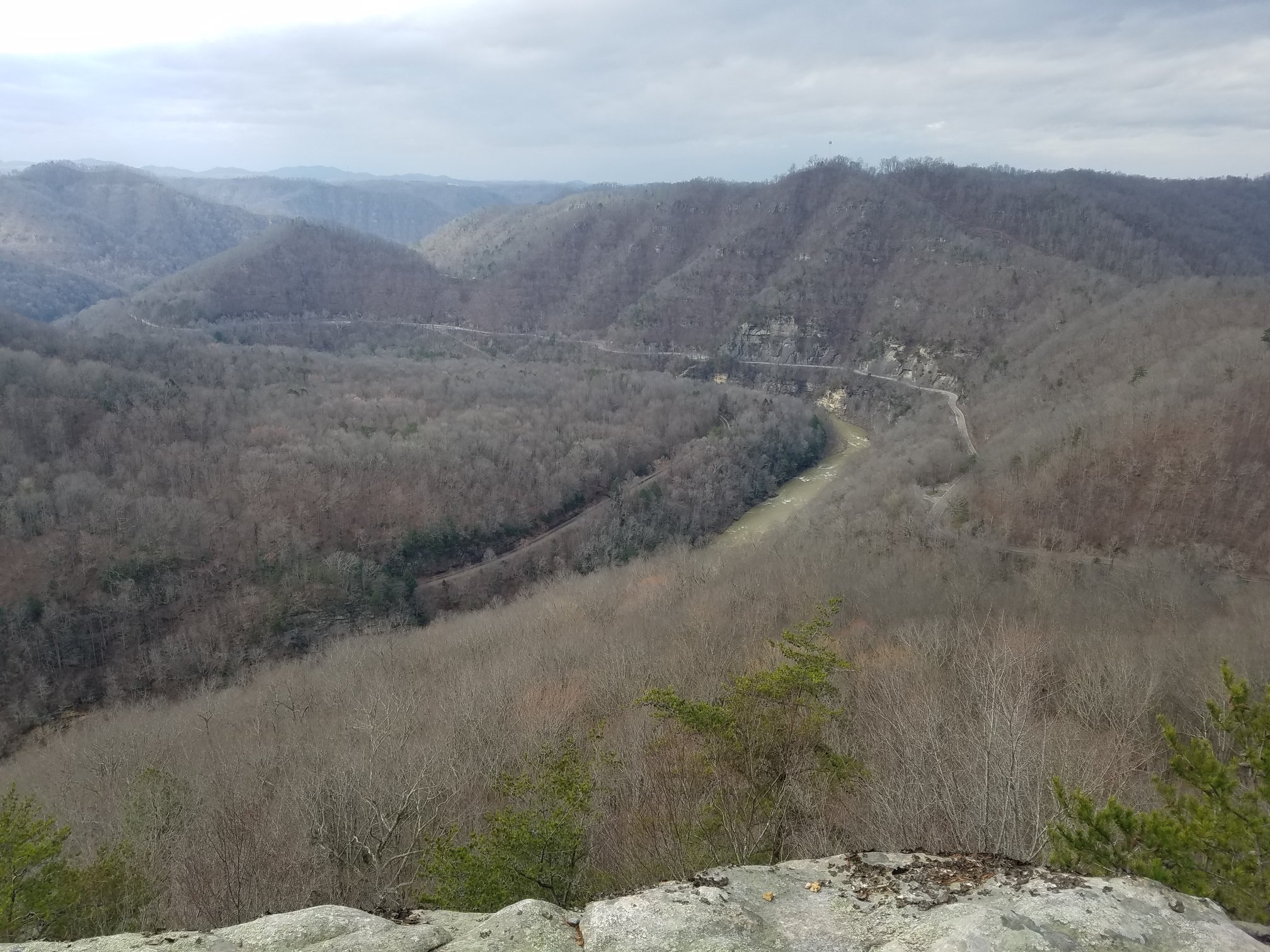
Stand at the rim and look down. The Russell Fork thunders through a gorge about five miles long and up to roughly 1,600 feet deep, widely billed as the largest canyon east of the Mississippi. Pine Mountain runs 125 miles with only a handful of gaps, and this break is the one the river cut.
The park straddles the Virginia and Kentucky line and is one of only two interstate parks in the United States. Virginia and Kentucky passed its compact in 1954, Congress consented that July, and the park opened in 1955. Today it offers overlooks above the Towers, more than twenty miles of trails, climbing, a canyon rim zipline, Laurel Lake, the Rhododendron Lodge, and guided elk tours.
In the fall of 1767, Daniel Boone came looking for a way west into Kentucky. He followed the Russell Fork downstream, skirted the gorge at the Breaks, and wintered at a salt spring near present-day Prestonsburg without realizing he had already reached Kentucky. The park credits him with naming the Breaks. A few years later he lived on the Clinch River at Castle's Woods, where his son James was killed in 1773.
Before there was a Dickenson County, there was a legend. In the 1760s, the story goes, John Swift worked a secret silver mine west of the mountains, hid bars and coins in rock shelters, and came back years later blind, never to find it again. In the Dickenson County version, Swift, Jefferson, and Munday found the silver deep in the Cumberlands, and the clues point to a forked oak with a pine knot wedged in it. Pioneers Joseph Kelly and John Ervin searched the McClure River country. Nobody has ever found it.
Just downstream from Haysi, the Yellow Poplar Lumber Company built a concrete splash dam and on December 4, 1909 sent about 36,000 logs through the Breaks on a manufactured flood. The name stuck to a coal town that grew beside the river. On June 13, 1932, an explosion at the Splashdam No. 6 mine killed ten men, and the January 1957 flood destroyed the town. The old dam still carries the Route 611 bridge at Bartlick.
Ralph Stanley was born on February 25, 1927, and raised on Big Spraddle Creek near McClure. With his brother Carter he formed the Stanley Brothers in 1946 and helped shape bluegrass. He won a Grammy for his a cappella "O Death," joined the Grand Ole Opry, and received the National Medal of Arts. The Ralph Stanley Museum is in the historic Chase House at 249 Main Street in Clintwood, 13 miles, 29 minutes from the lodge, and the Hills of Home Festival fills Smith Ridge near McClure every Memorial Day weekend.
After the floods, the U.S. Army Corps of Engineers built the John W. Flannagan Dam on the Pound River between 1960 and 1964, a 250-foot rock-fill dam with a central clay core named for Congressman John W. Flannagan Jr. Behind it lies Flannagan Lake, about 1,145 acres of deep, clear water with campgrounds, boat ramps, and a marina. Every October the Corps lowers the lake, and those releases turn the Russell Fork through the Breaks into some of the hardest whitewater in the East.
Every page below is researched, sourced, and written for travelers who like to know the story behind the place.
The 1909 log drive, the June 13, 1932 mine explosion, and the 1957 flood that ended a coal town.
Pine Mountain, Daniel Boone, the Battle of the Breaks, and the 1954 compact that made a two-state park.
Hayter and Sifers, the 1900 post office, and the legend of shouting Hey, Si across the river.
The journal, the forked oak, the blind man's search, and 250 years of hunting around the Breaks.
The 1767 long hunt down the Russell Fork, the winter at the salt spring, and the hard years on the Clinch.
Big Spraddle Creek, the Stanley Brothers, the museum in Clintwood, and the Hills of Home Festival.
The 1879 meeting at Nora, the 1880 act, and why the last county in Virginia is called Virginia's Baby.
Why the Corps built a 250-foot dam on the Pound River, and how it runs today.
The congressman from the Ninth District whose name the dam and reservoir carry.
On the first four full weekends of October, releases from Flannagan Dam turn the Breaks gorge into Class V water. Not a paddler? Watching from the rocks and overlooks is a spectacle of its own.
An observation deck at about 3,144 feet on Pine Mountain near Clintwood, the high point of the county, with views across several states on a clear day and a trail down to Jenny Falls.
Picnic shelters, a playground, pickleball, and tailwater fishing at the base of Flannagan Dam, 3.6 miles, 9 minutes from the lodge.
The Ridgeview Trails trailhead is at Haysi Kiwanis Park, 4.0 miles, 9 minutes from the lodge, with more of the Spearhead Trails system across the coalfields.
Dickenson County is a stop on Virginia's Heritage Music Trail, shaped by the church singing that gave the world the Stanley Brothers.
Walleye, bass, and crappie on Flannagan Lake and trout and smallmouth in the tailwater and rivers.
Wildflowers, laurel, and rhododendron fill the gorge. Elk tours run on selected dates, and Memorial Day weekend brings the Hills of Home Festival.
Flannagan Lake is at summer pool for boating, swimming, paddling, and camping. Long days suit the Breaks trails, the zipline, Birch Knob sunsets, and ATV riding.
The headline season. October brings blazing color across the Breaks and the Russell Fork whitewater release weekends. Book early.
Quiet, crisp, and uncrowded. Bare trees open up views into the gorge, and it is an ideal time for a peaceful retreat or a focused work getaway.
After a day on the rim of the Breaks or a night of bluegrass, come back to a private retreat on Big Ridge Road, State Route 63, 2.4 miles, 6 minutes from downtown Haysi.
Flannagan Lodge was fully remodeled in 2022 and 2023 and is designed for privacy: a private entrance, a private guest bathroom, and a private deck for lounging. Two queen bedrooms, the Splashdam Room and the Breaks Room, sleep up to four registered guests. The Flannagan Room is set up for dining, work, and card games, and by advance request and for an added fee it can be prepared as a third sleeping room, allowing up to six registered guests. Each room has a 32-inch Roku smart TV.
Check-in is self-service: your keypad code is sent through the Airbnb or VRBO app, so you never need to meet a host for a key. One pet is welcome with restrictions and an added pet fee, and because the lodge sits beside State Route 63, pets must be on a leash at all times.
Reservations are accepted only through Airbnb and VRBO.
Dickenson County was formed in 1880 as the last county ever created in Virginia, so it is the Commonwealth's youngest county and is known as Virginia's Baby.
William J. Dickenson, a Russell County delegate who sponsored the bill to create the county in the Virginia House of Delegates in 1880.
From storekeepers Charles M. Hayter and Otis L. Sifers, who joined the first syllables of their surnames when the post office in their store opened in 1900. A popular legend credits travelers shouting "Hey, Si!" to a ferryman, but historians favor the storekeepers.
Yes. In the fall of 1767 Daniel Boone followed the Russell Fork past the Breaks on his first attempt to reach Kentucky, and Breaks Interstate Park credits him with naming the area.
The gorge is about five miles long and reaches roughly 1,600 feet deep. Published figures vary by measuring point, and it is widely billed as the largest canyon east of the Mississippi River.
Releases from John W. Flannagan Dam typically run on Saturdays and Sundays of the first four full weekends of October. Confirm each year's schedule with the U.S. Army Corps of Engineers.
No one has ever proven the mine existed or found its location. The legend of John Swift's lost silver has been told across Virginia, Kentucky, West Virginia, and Tennessee for more than 200 years, and many believe it lies in the Breaks.
Dr. Ralph Stanley was born in 1927 and raised on Big Spraddle Creek near McClure in Dickenson County, Virginia. The Ralph Stanley Museum is in Clintwood, and the Hills of Home Festival is held near McClure each Memorial Day weekend.
Splashdam is an area on the Russell Fork just downstream of Haysi named for a logging splash dam built by the Yellow Poplar Lumber Company, which drove 36,000 logs through the Breaks in 1909. A coal town grew there, ten men died in a 1932 mine explosion, and the 1957 flood destroyed the town.
Flannagan Lodge is a private, fully remodeled guest suite on State Route 63 just outside Haysi, 10 miles, 20 to 25 minutes from Breaks Interstate Park, bookable only on Airbnb and VRBO with self check-in.
This guide was researched and written by Joseph Boyd for Flannagan Lodge. Each linked history page carries its own full source list. Hours, fees, release dates, and festival schedules change, so confirm with each attraction before you travel. If you find an error, please contact us and we will correct it.
Last reviewed: November 2026